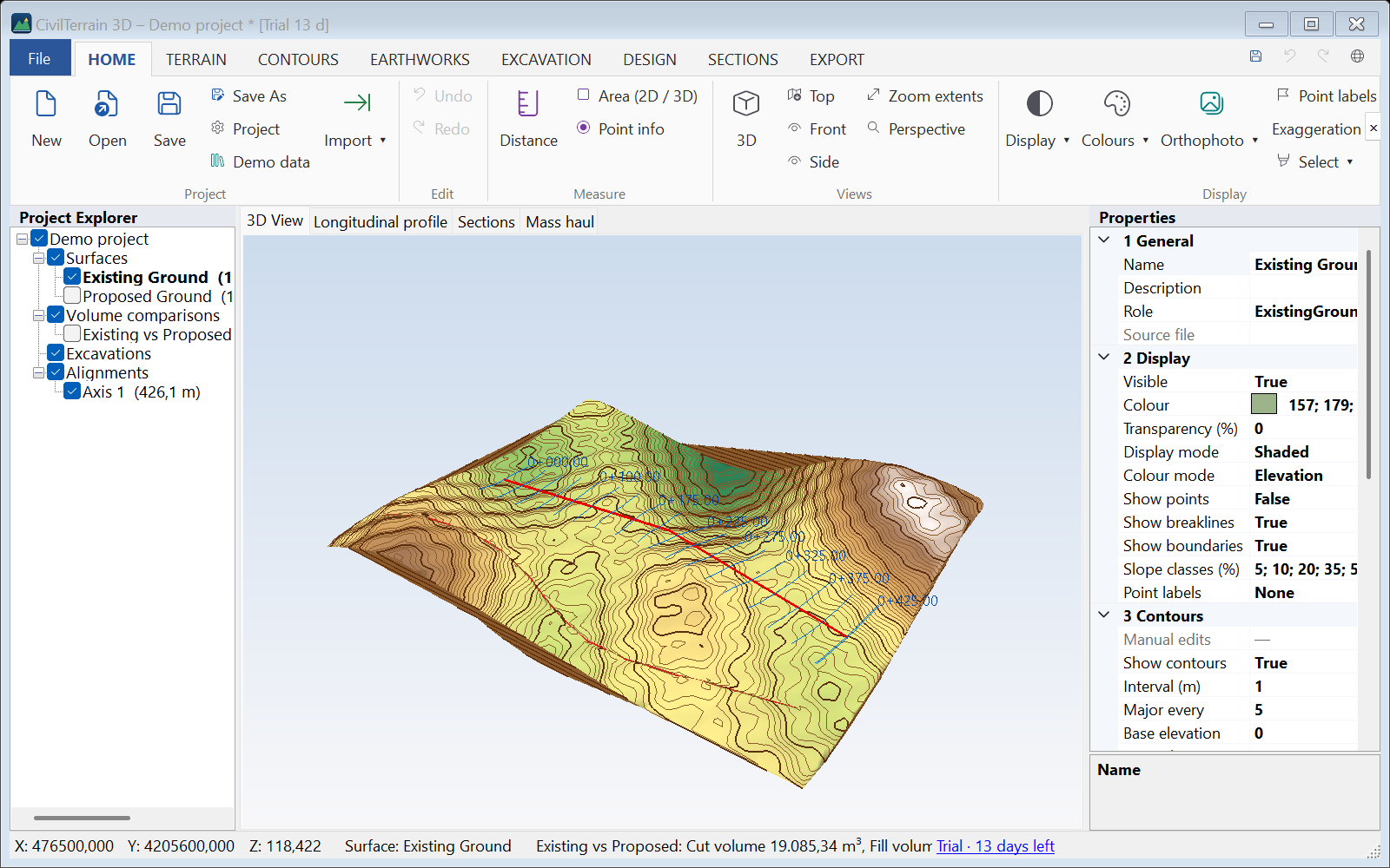
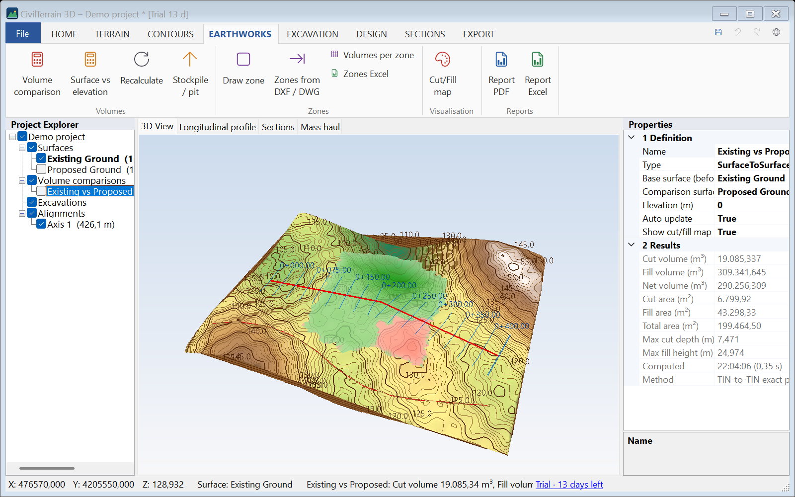
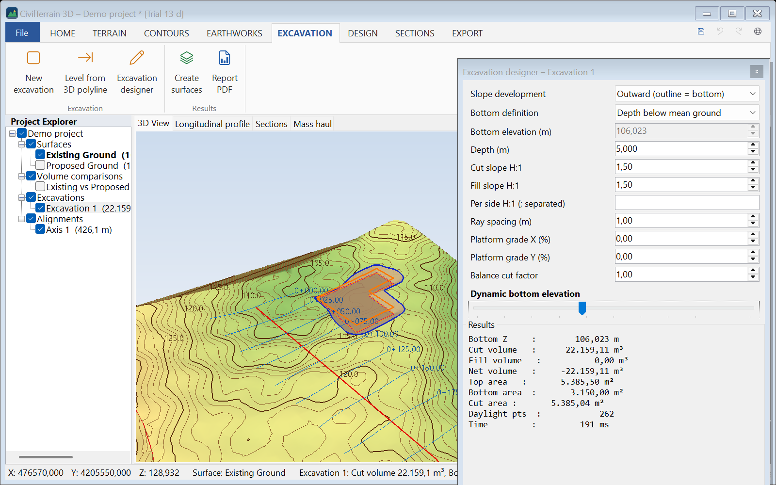
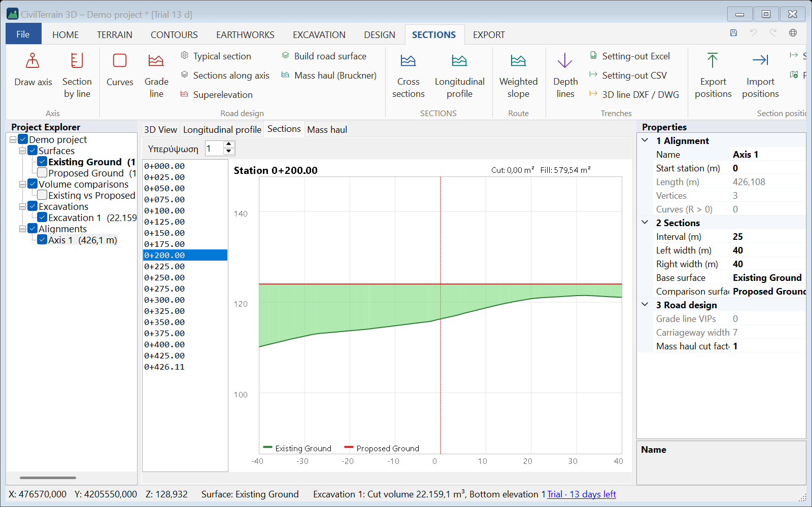
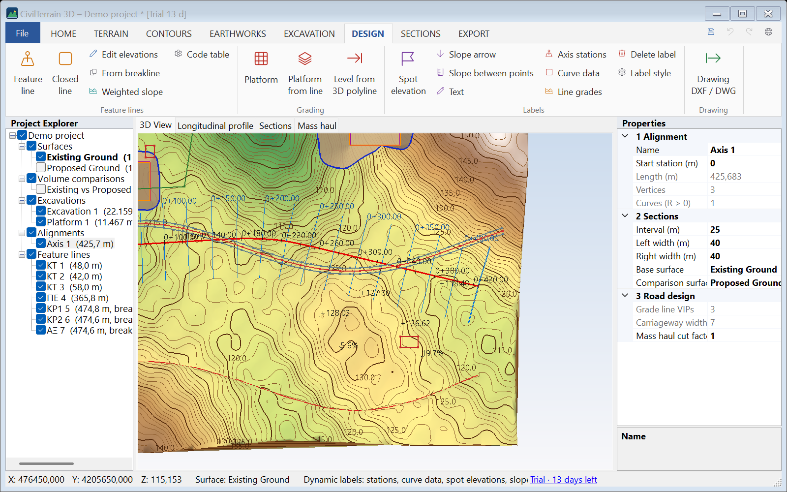
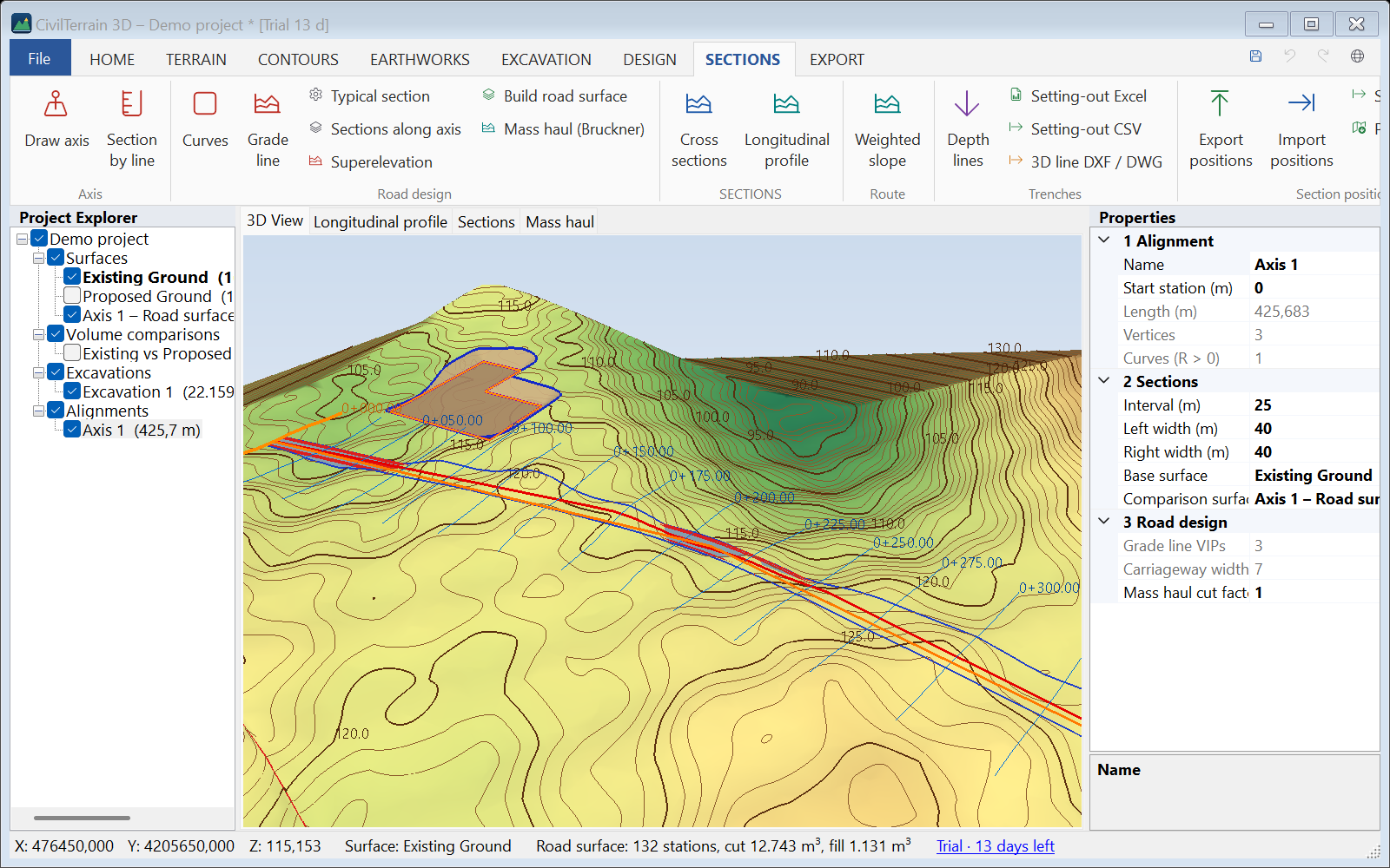
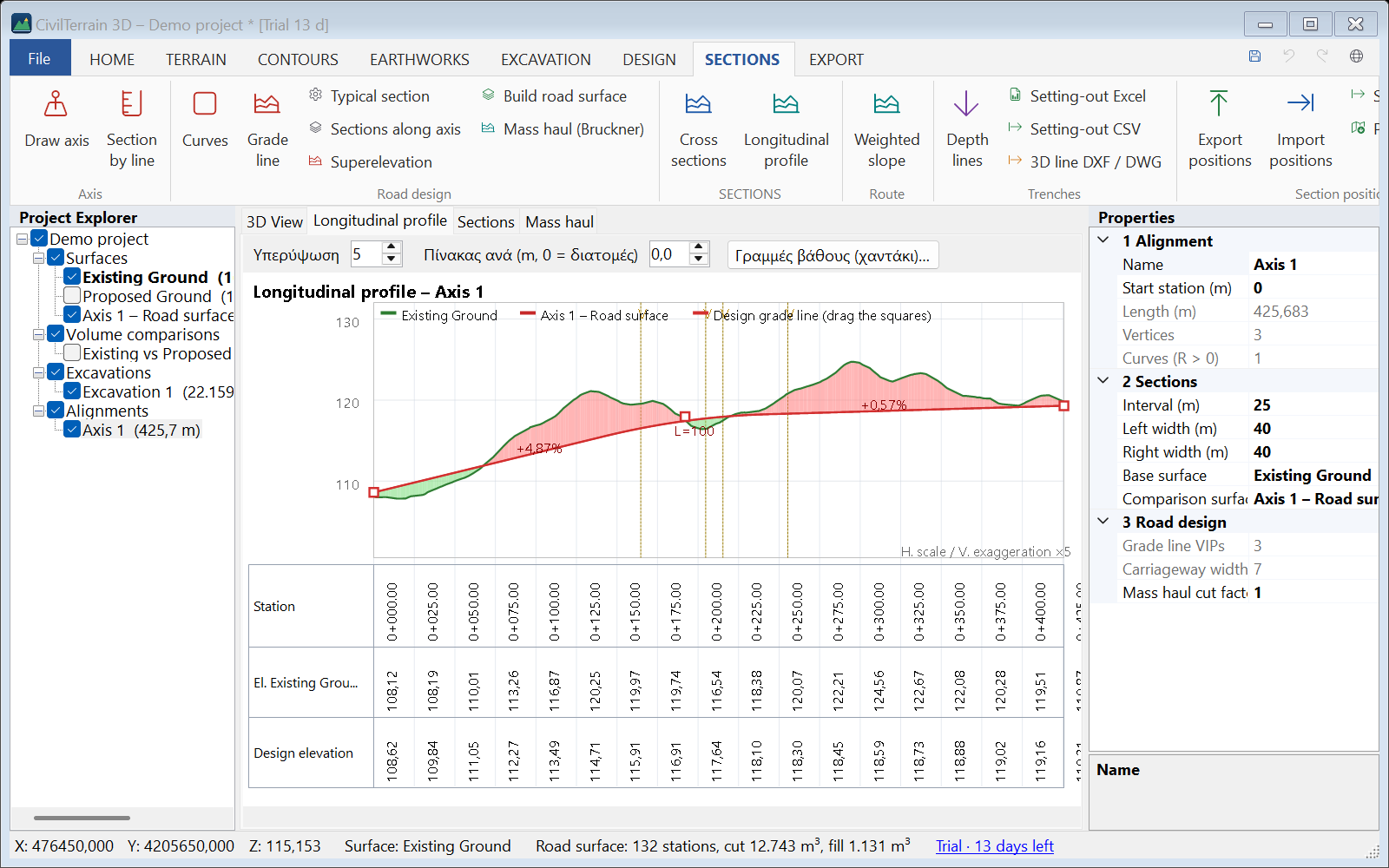
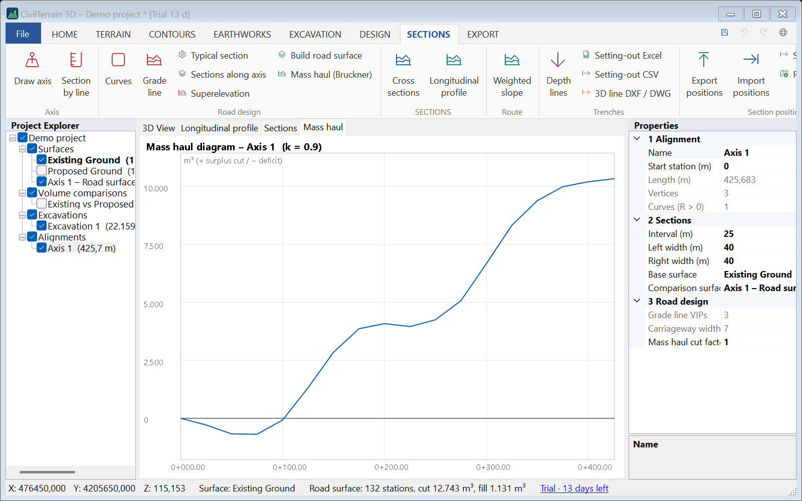
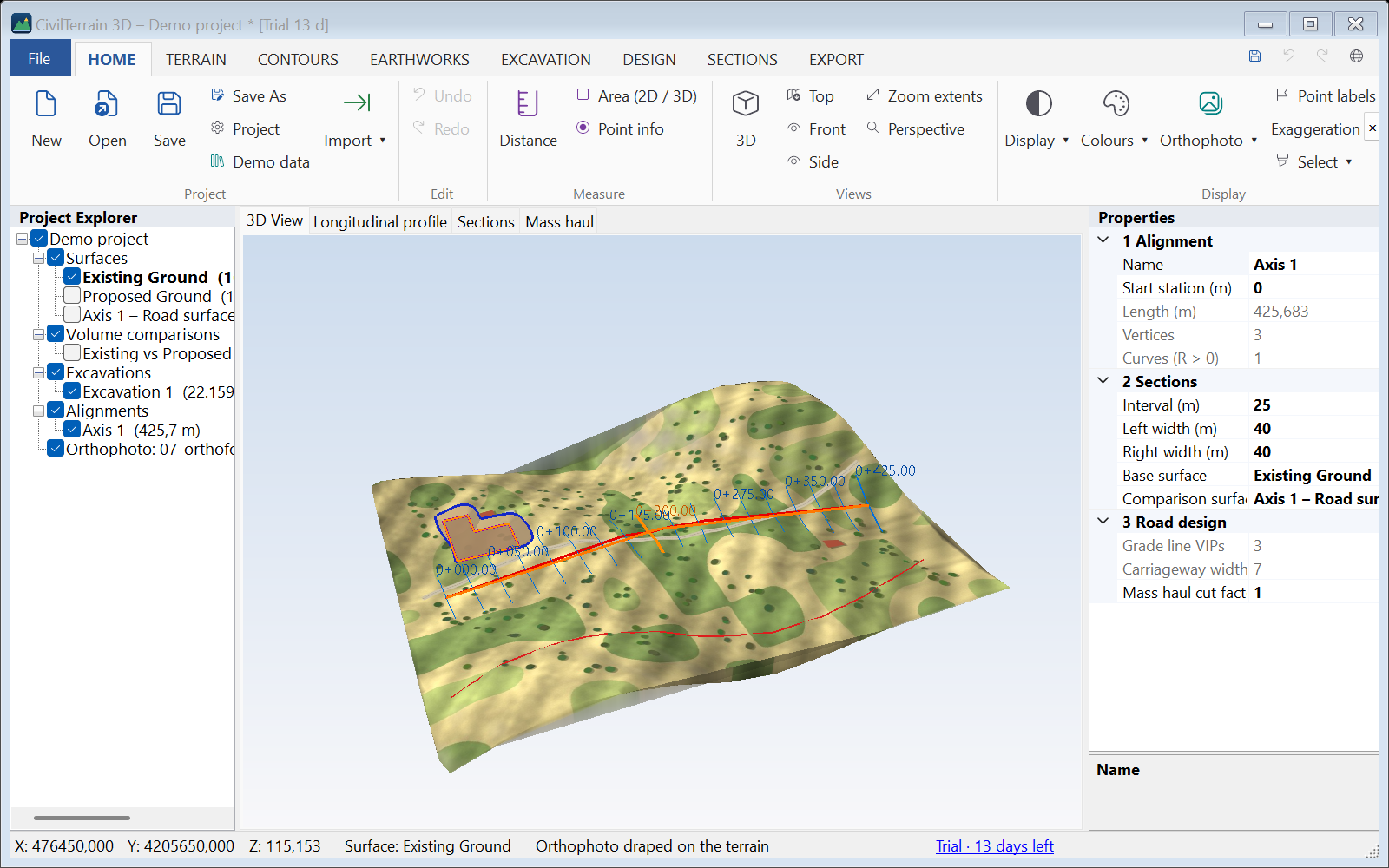
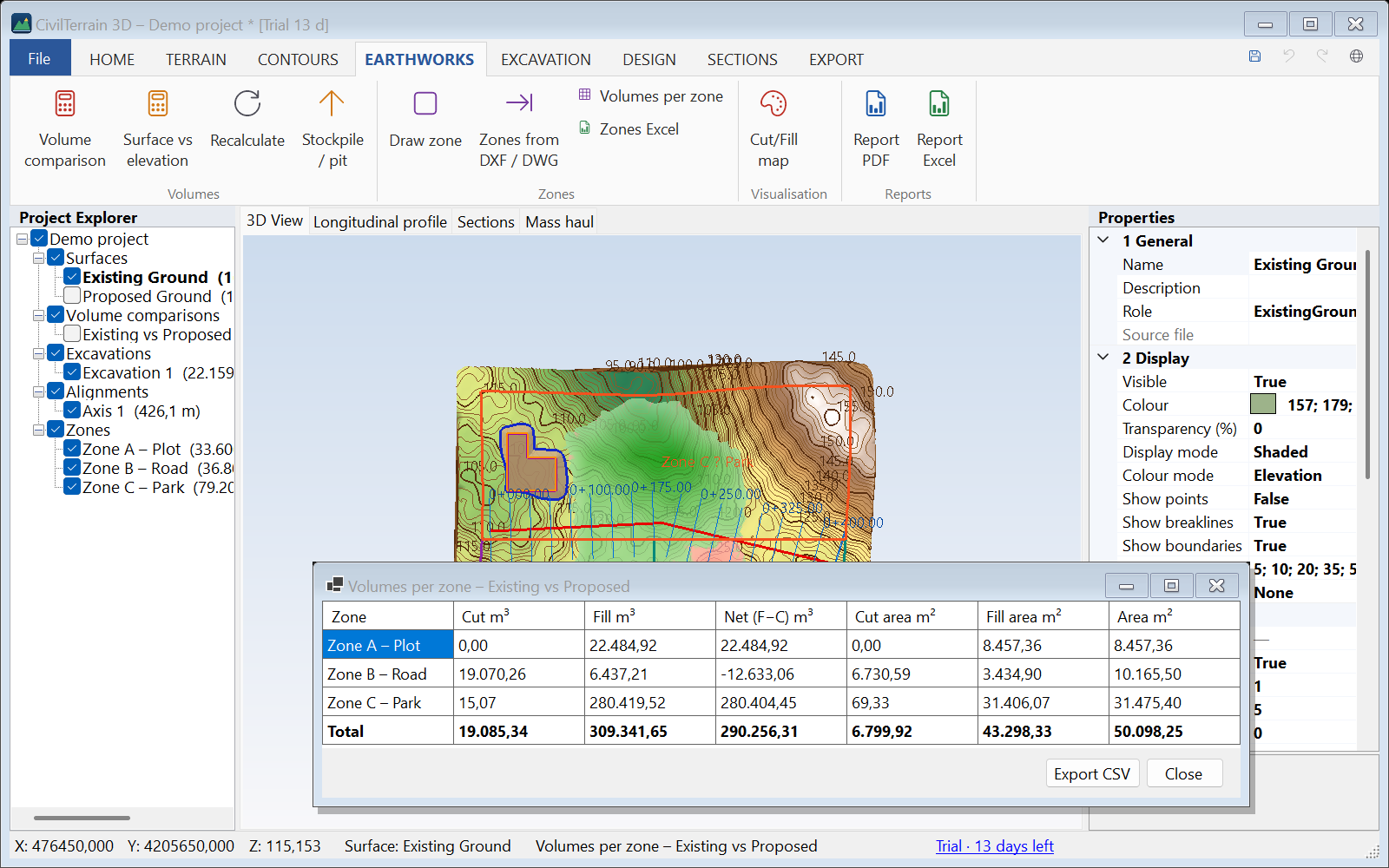
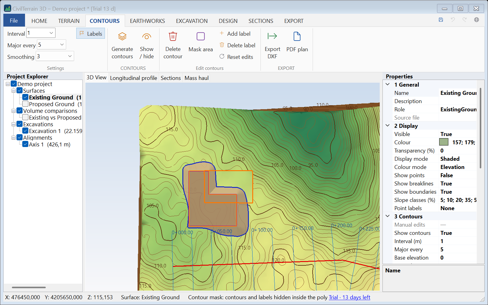
One tool, from importing your points to the final report.
⛰️
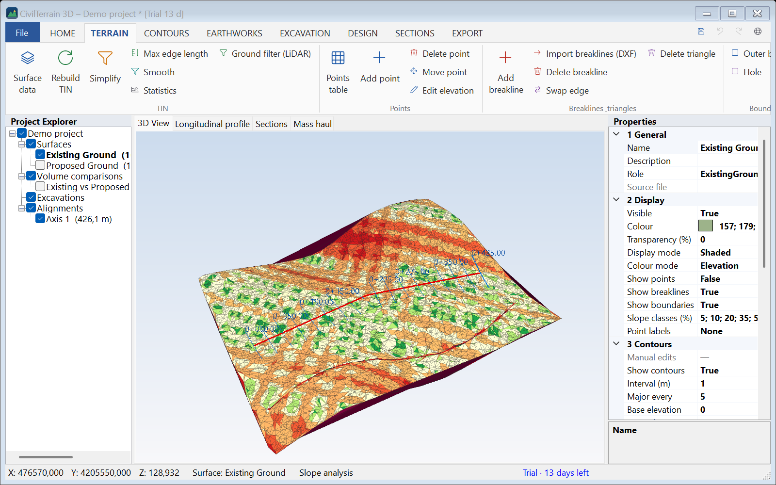
Terrain model (TIN)
Delaunay triangulation with breaklines, outer boundaries, holes and a maximum edge length. Multiple surfaces in the same project.
〰️
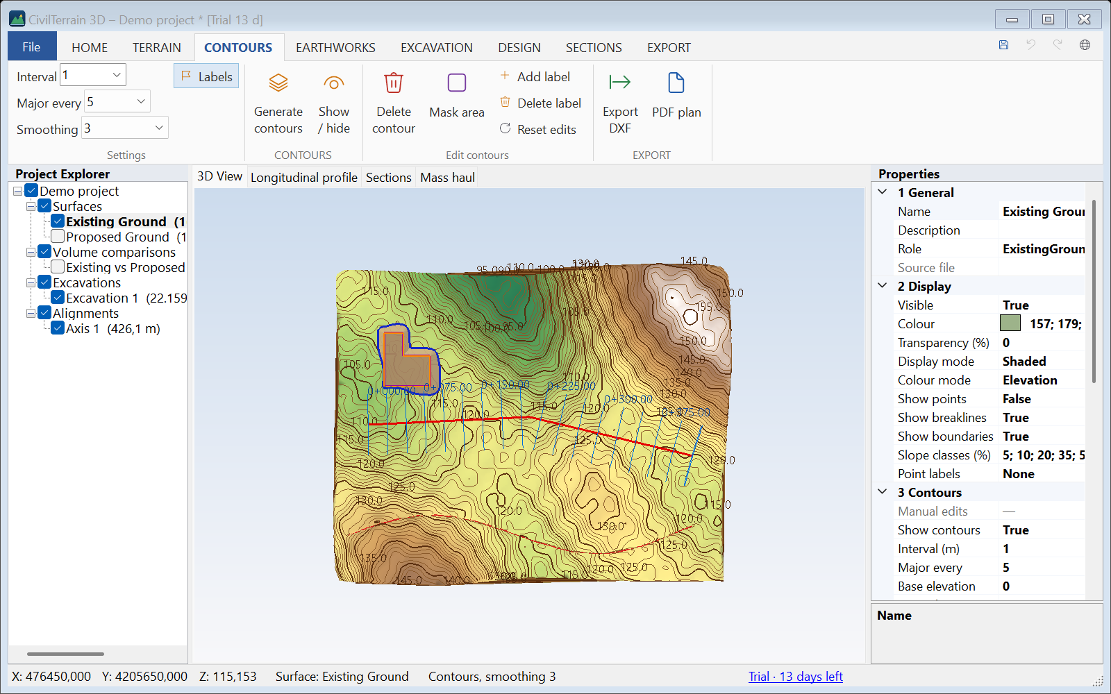
Contours new in 1.6.6
Major and minor contours, smoothing and export to DXF or PDF. Elevation labels where you want them: on major contours, every N-th contour, every 5 m of elevation or given elevations, as often as you set.
🚜
Earthwork volumes
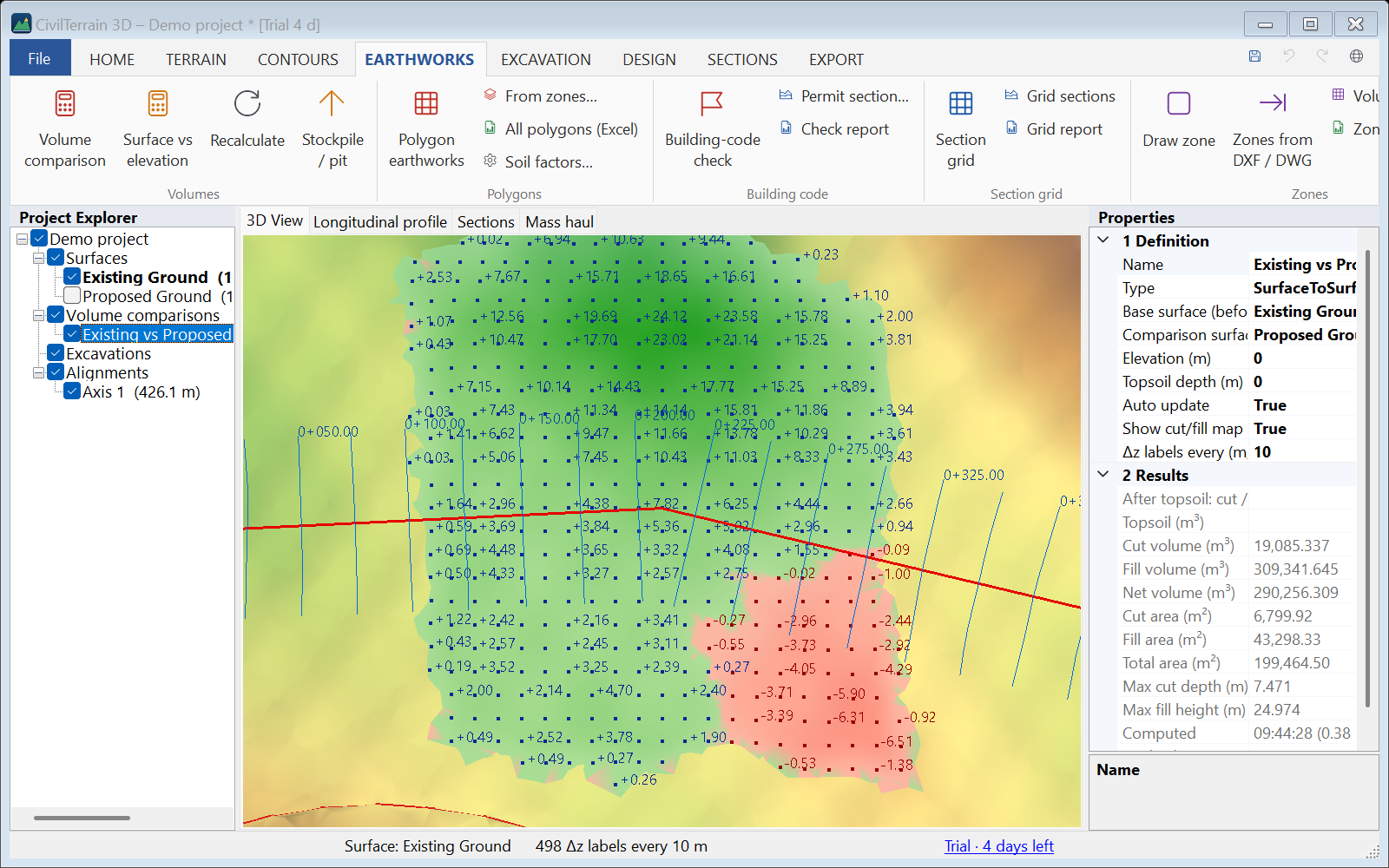
Cut, fill and net volume between two surfaces or between a surface and an elevation, with a cut/fill map.
🔺
Triangles and contours from a spot grid new in 1.6.14
With one option, the points of a spot grid (e.g. every 20 m) become a surface with triangles and contours only inside the perimeter, over the drone survey or the orthophoto, updated with the grid.
🎯
Centroids of the earthworks new in 1.6.14
The centroid of the cut volume and of the fill volume, with the distance between them for hauling, in polygon earthworks and volume comparisons: in the window, the Properties, the PDF / Excel reports and, if you wish, the drawing.
🗺️
Routes without a surface new in 1.6.13
The 3D polylines of a DXF / DWG (roads, networks, cables many km long) become 3D lines, with no surface to build. One click on a line gives its weighted slope, and all the routes together come in one table with totals, Excel and CSV.
📍
Spot grid new in 1.6.12
Points every so many metres inside a perimeter, with their elevations on the survey or the orthophoto (e.g. “48.62 m”) and, optionally, the Δz to the design. Numbered for setting out and checking, as CSV, TXT (PNEZD), DXF / DWG, Excel and a PDF at scale.
🚚
Remove objects new in 1.6.12
Machines and trucks come off the drone survey: found automatically, with a list to check, or you draw their outlines. The ground under them is made from the ground around, on point clouds, RGB clouds and DEM / DSM.
⛏️
Replace terrain new in 1.6.12
Encircle debris or a deposit inside an excavation and the ground comes down to the ground around it. Into a copy, the comparison gives the volume of the material at once.
🌓
Themes new in 1.6.11
Light, Dark (Windows 11), CivilShop or as Windows. The dark theme covers the ribbon, tree, tables, profile, cross sections and the 3D view. Reports and exported images always keep a white background.
📐
Sloped design new in 1.6.10
Draw sub-areas with a grade on each side as you draw. You get at once the design surface with side slopes and its cut / fill against the ground, with volumes per area.
💧
Water flow and basins new in 1.6.9
Where the water runs and where it stays, with the depth and volume of each pool. A drainage basin from one click at the outlet: area, longest flow path, time of concentration and peak flow.
📐
Grading optimization new in 1.6.8
Inside an outline: the least earthworks for a largest grade (e.g. 5%), with drainage where you draw water paths and outlets, points of given elevation, limits and balance.
🕳️
Dynamic excavation
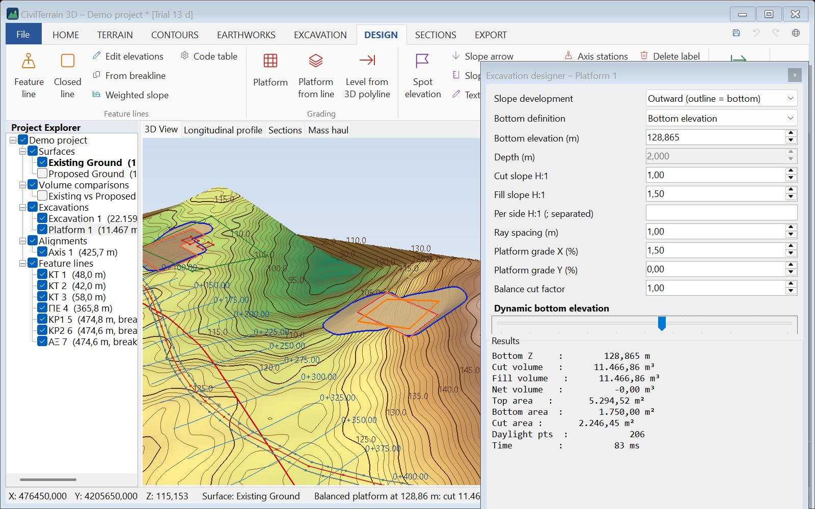
Draw the outline, set the side slopes and change the depth with a slider — volumes update instantly.
📈
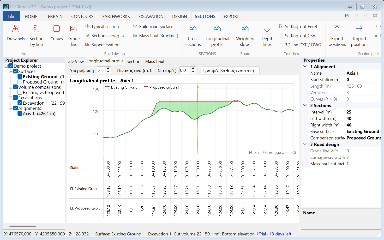
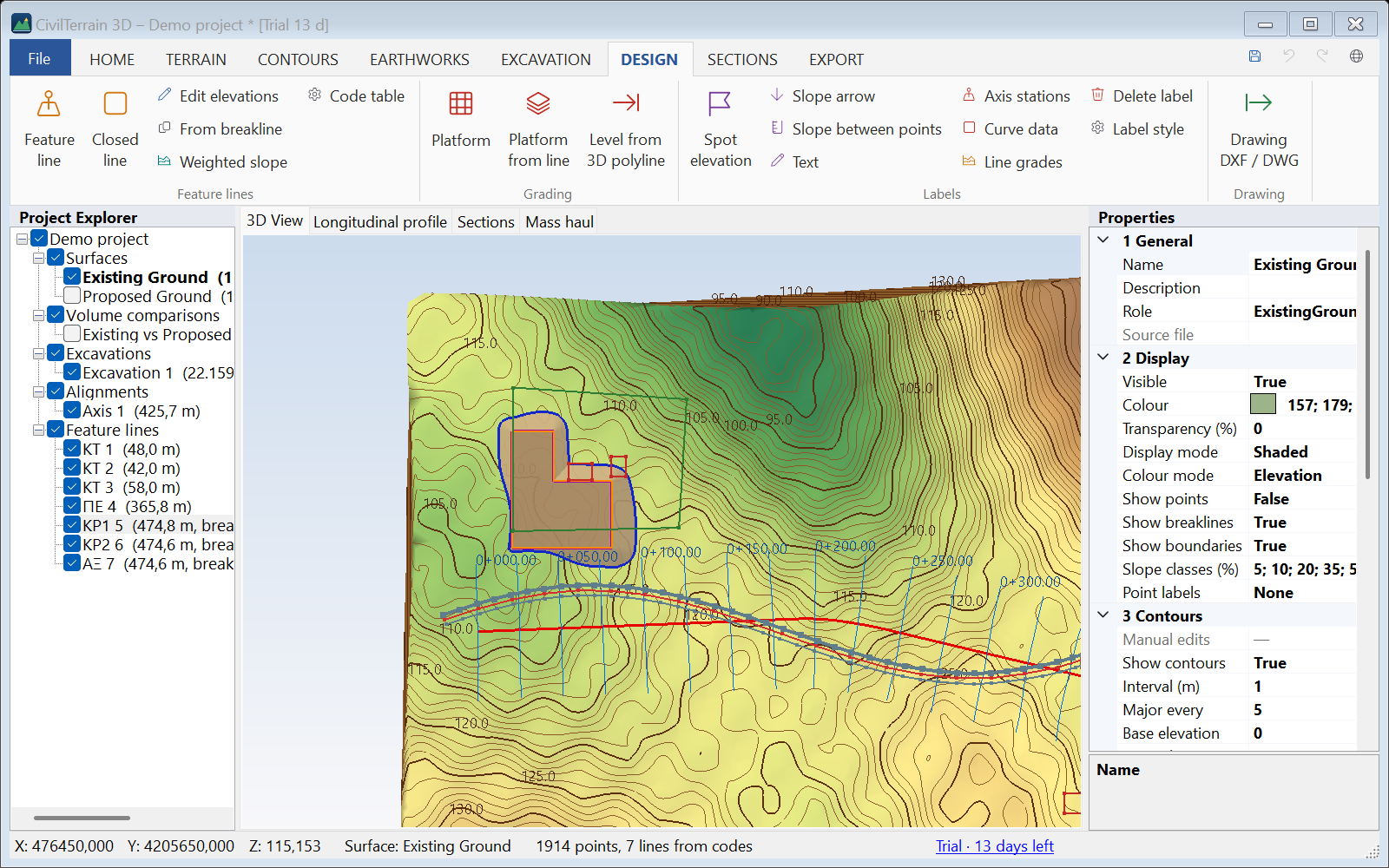
Cross sections & profiles
Cross sections at any interval you like, cut/fill areas and volumes by the average end area method.
🛠️
Terrain editing
Add or move points, change elevations, flatten areas, raise or lower ground — with full Undo/Redo.
🛣️
Follow a road / channel new in 1.6.5
In a LiDAR / drone cloud: from a rough line and the typical section, crest, toe, edges and ditches become breaklines, and the ground is cleared of vehicles and vegetation without losing the edges.
⛰️
DEMs in every format new in 1.6.4
GeoTIFF / BigTIFF, ESRI ASCII Grid, SRTM and BIL / FLT, transformed into the project’s system (e.g. WGS 84 → GGRS87), with only the project area taken from large tiles.
🗂️
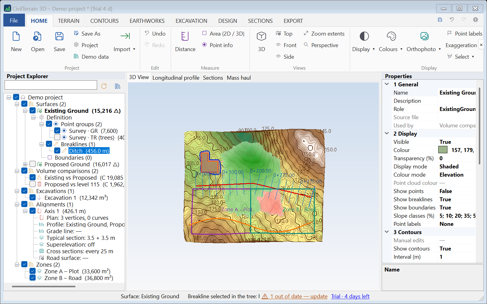
Project tree new in 1.6.3
Point groups, breaklines and boundaries of every surface with check boxes, alignment parts by double-click, ⚠ whatever is out of date, an item list and selection by clicking in the drawing.
🔢
Δz map new in 1.6.2
After − before differences on a grid at any spacing (e.g. every 10 m) over the cut / fill map, in the PDF / Excel report and in DXF / DWG for AutoCAD.
🎨
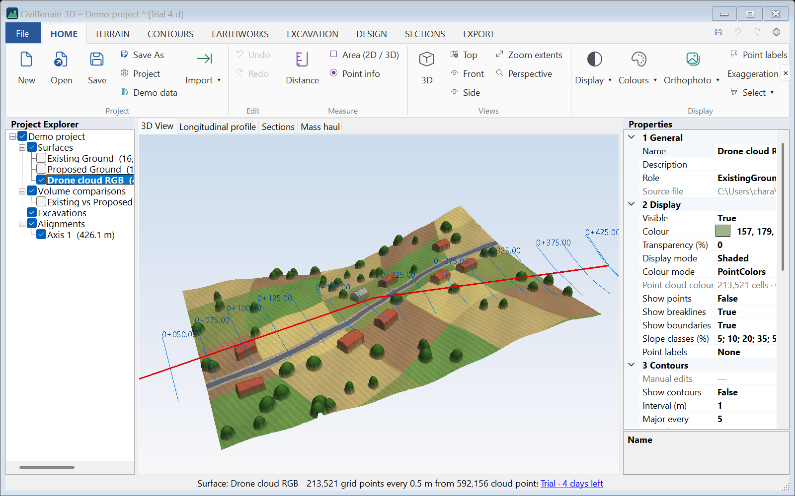
Point clouds in RGB new in 1.6.2
A drone cloud as a gridded surface at the sampling you type and in its real colours, with no orthophoto; shaded, wireframe or points with one click.
🧭
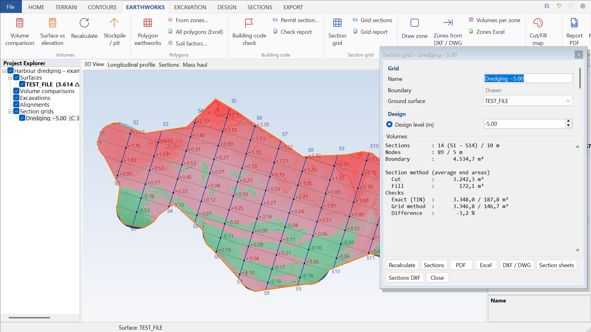
Section grid & volumes new in 1.6
Parallel cross sections every few metres inside a boundary, grid nodes with Δh, areas and volumes by the average end area method — checked against the exact TIN volume. Ideal for dredging, yards and excavations. PDF report, Excel and DXF/DWG.
📋
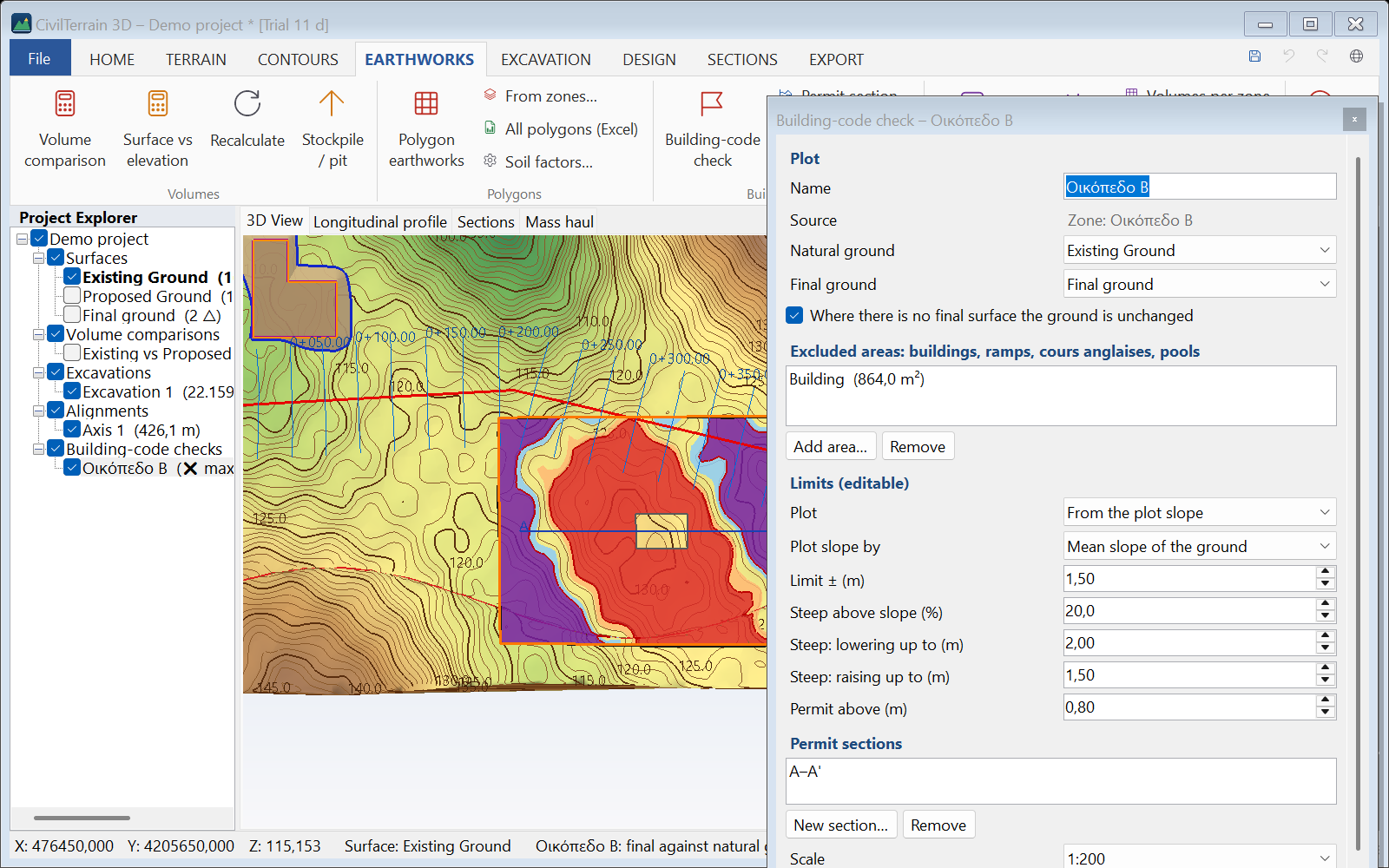
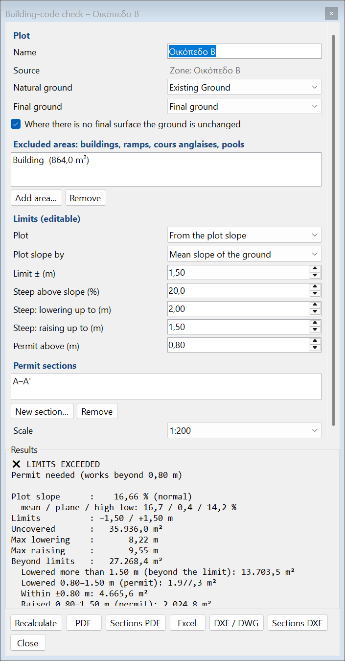
Building-code level check (ΝΟΚ) new in 1.5
Final against natural ground over the whole uncovered plot area: ±1.50 m (steep plots >20 %: −2.00 / +1.50 m), 0.80 m permit threshold, buildings and ramps excluded, a class map and the points beyond the limits. All limits are editable.
✂️
Permit sections new in 1.5
Sections at 1:100 / 1:200 / 1:500 with natural and final ground, the allowed range, buildings and plot boundaries — in PDF and DXF/DWG, together with a PDF / Excel report.
🏗️
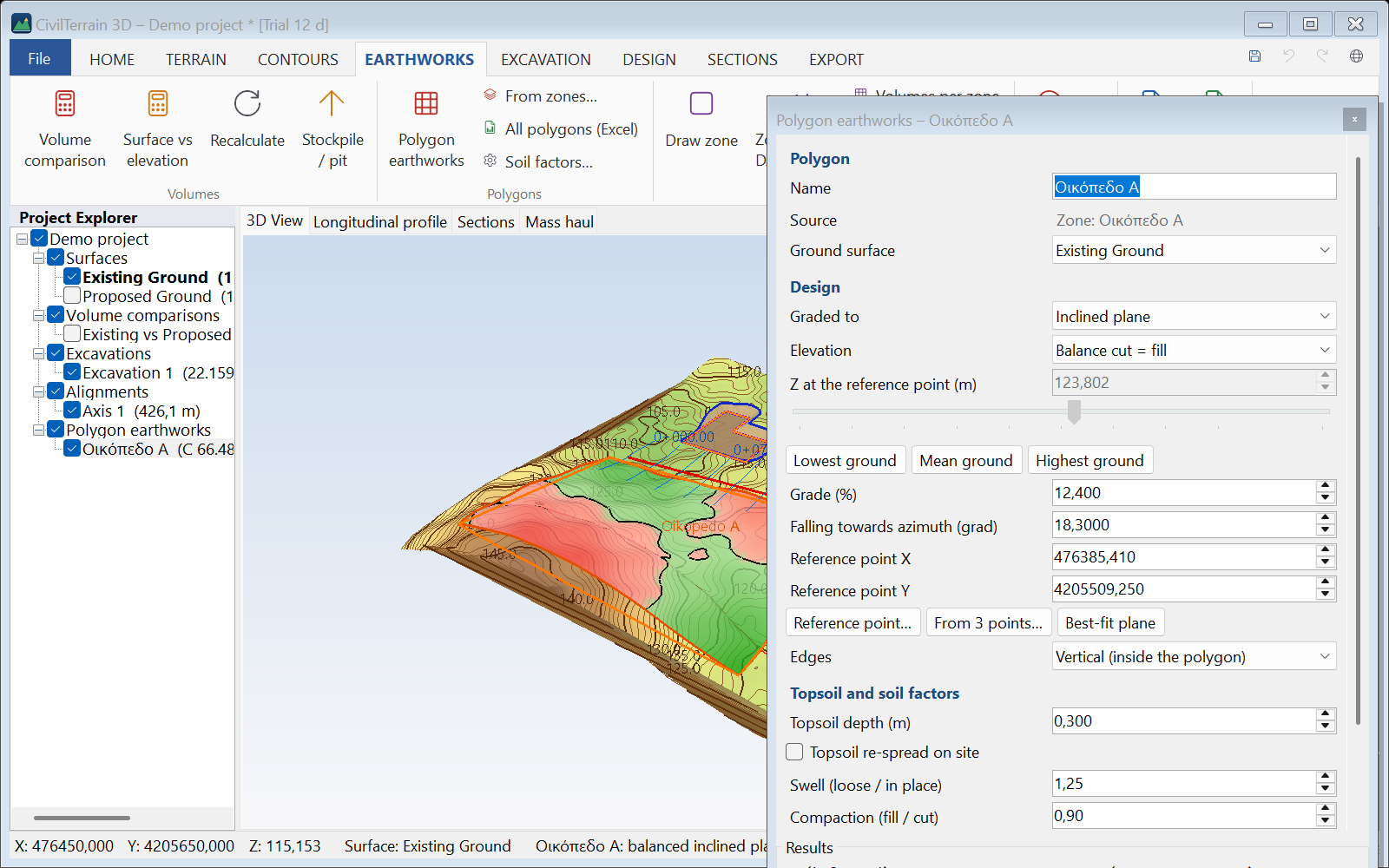
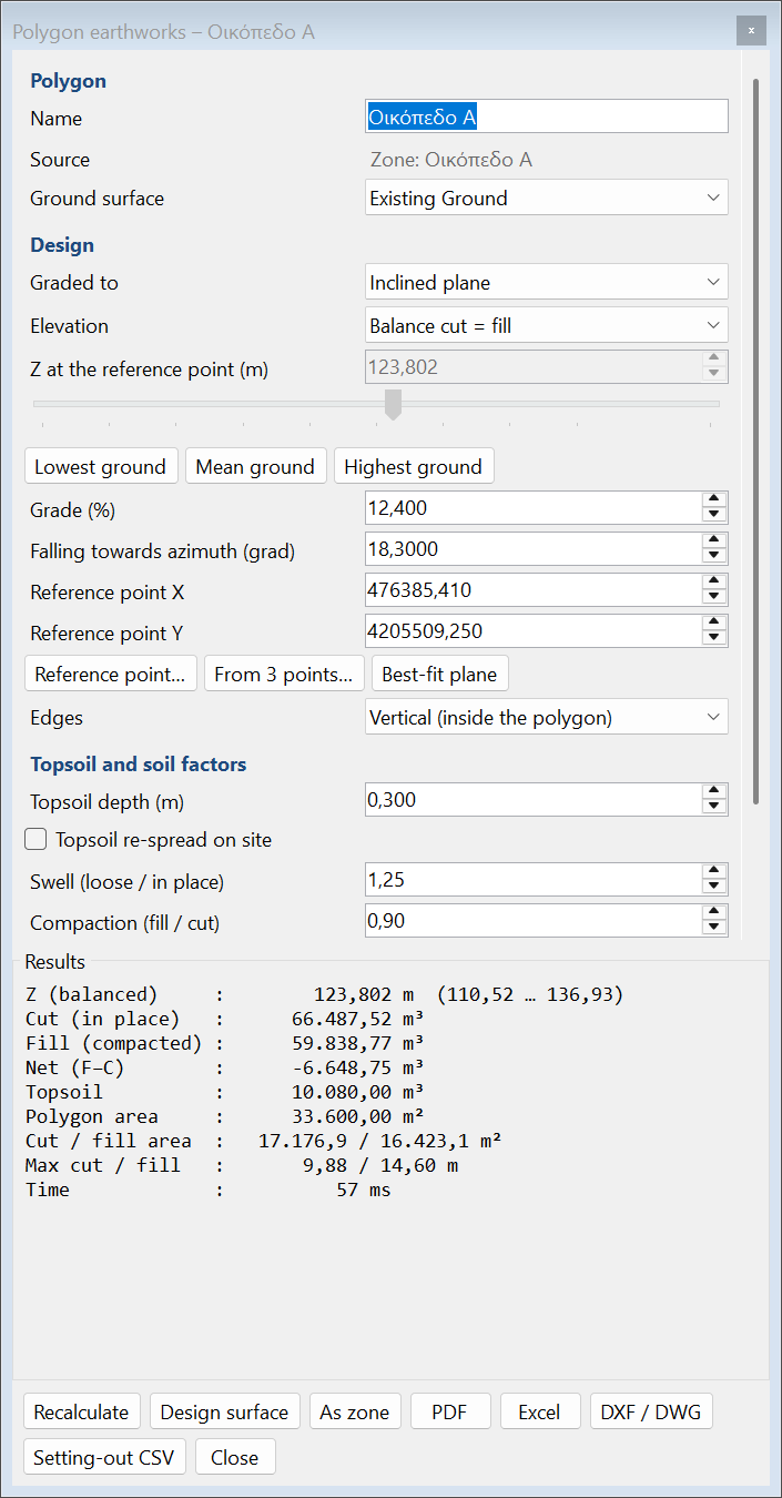
Polygon earthworks new in 1.4
Pick a plot or pad (zone, closed line, DXF/DWG or coordinates) and get cut / fill instantly for a level or inclined plane, with balance, side slopes and a live slider.
🌱
Topsoil, truck trips & ΣΔΑ new in 1.4
Topsoil stripping, swell / compaction factors, surplus or borrow with truck trips, and an excavation-waste table (ΣΔΑ – construction-waste management plan, EWC 17 05 04) in the reports.
🔌
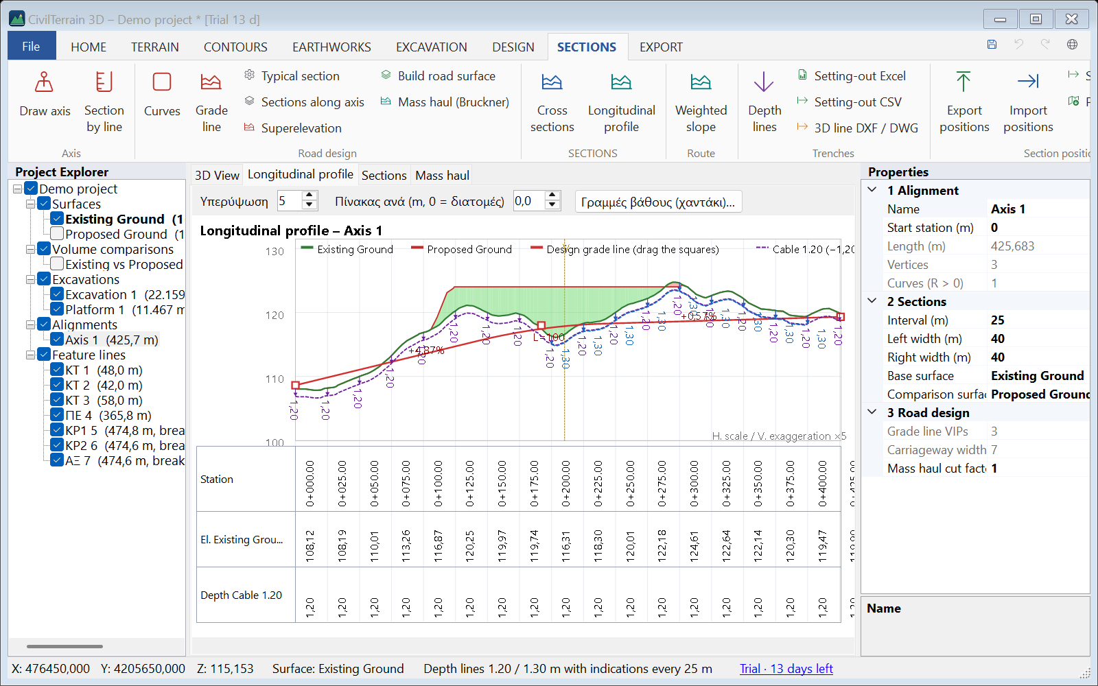
Cable & pipe trenches new in 1.3
Depth lines below the long profile (e.g. 1.20 / 1.30 m), depth marks at any interval, trench volume, a setting-out table in Excel/CSV and a 3D line in DXF/DWG.
🗺️
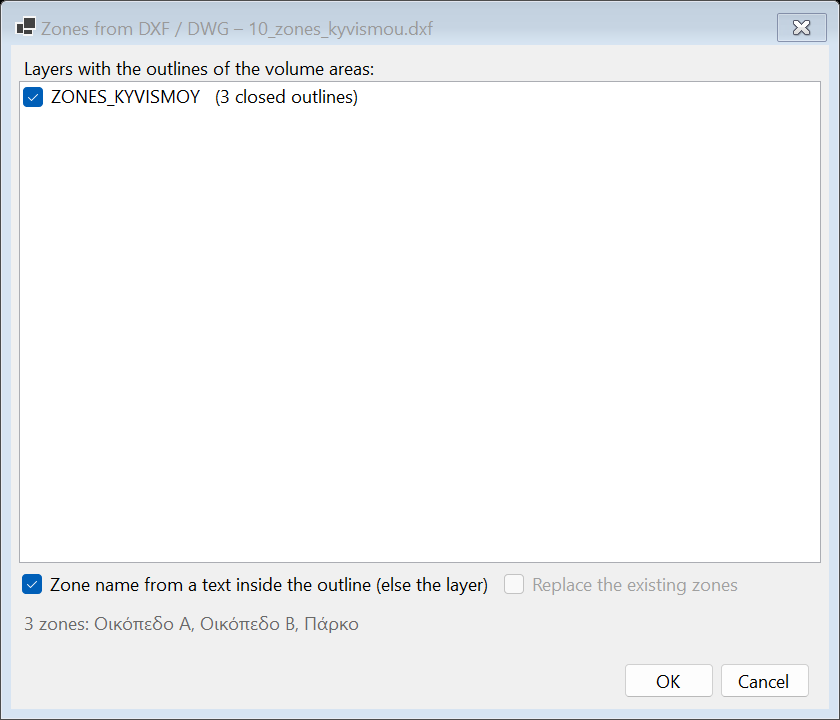
Volume zones from DXF/DWG new in 1.3
The outlines already in your drawing become zones in one click — named after the drawing's texts — and the volume per zone is available immediately.
📉
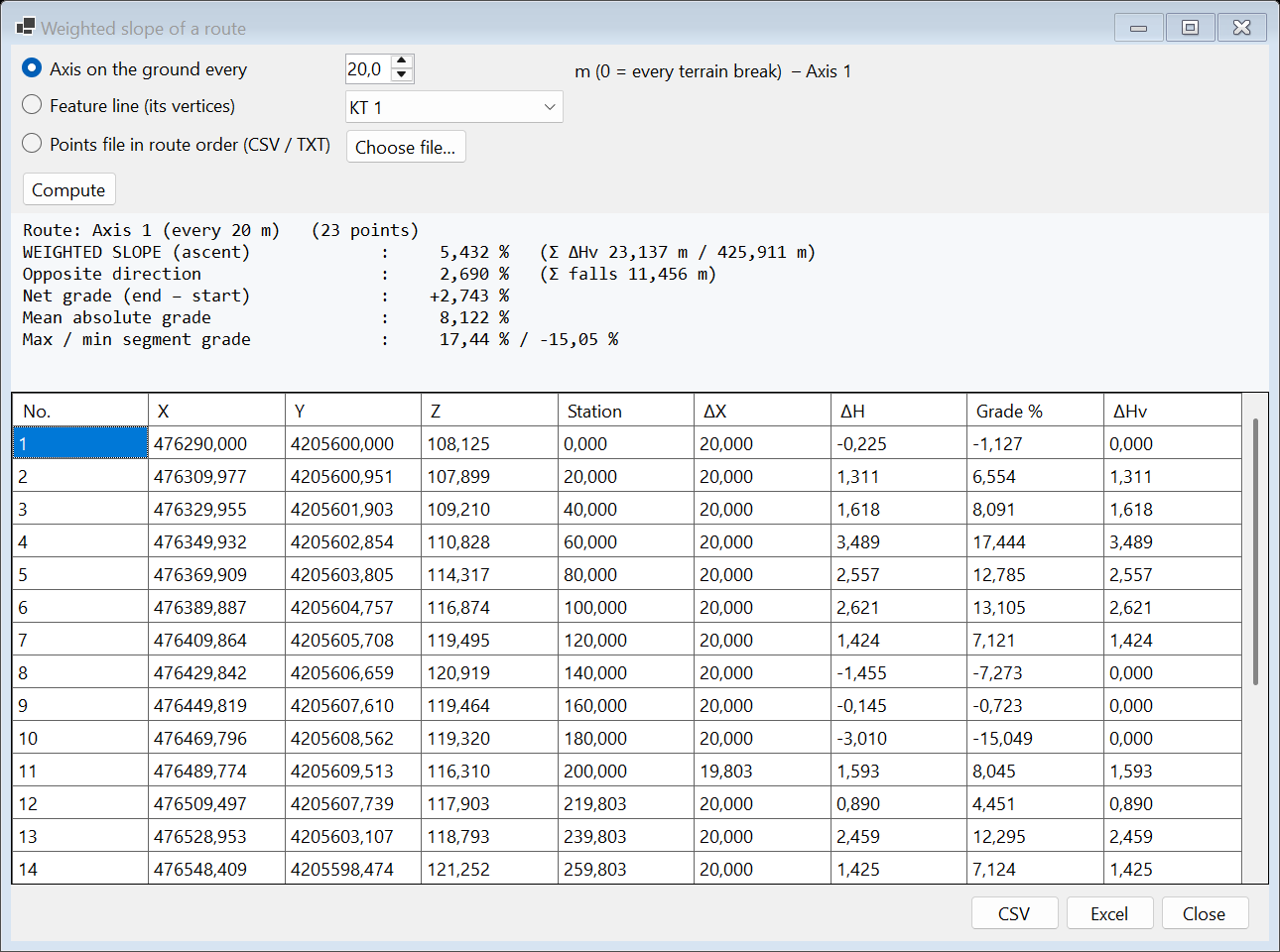
Weighted slope new in 1.3
Σ rises / route length from an axis, a line or a points file, with the classic table (No., X, Y, Z, Station, ΔX, ΔH, Grade, ΔHv) in Excel.
⚖️
Balanced platforms new in 1.2
Graded pads with side slopes that find the elevation where cut = fill on their own. Feature lines with elevations and grades.
📏
DWG & point codes new in 1.2
Open and save DWG without AutoCAD. Automatic linework from survey point codes (curbs, centerlines, buildings).
🛣️
Road design new in 1.1
Arcs and clothoids, a grade line with vertical curves you drag with the mouse, typical section, road surface and mass-haul (Bruckner) diagram.
🛰️
Drone, LiDAR & orthophotos new in 1.1
Ground filter for unclassified point clouds, and orthophotos (GeoTIFF / world file) draped over the terrain.
📐
Measurements, stockpiles & zones new in 1.1
3D distances and areas, stockpile/pit volumes, volumes per zone, a point table and contour editing.
🗺️
Scaled drawings new in 1.1
Plans and cross sections on A4–A0 sheets with title frame, legend and your logo, ready to print.